
EMGA Mitchell McLennan Pty Ltd (EMM) was engaged by Baulderstone Pty Ltd, on behalf of Transport for NSW (TfNSW), to complete heritage services for the early works package of the Sydney Metro Northwest, formerly known as North West Rail Link ), including an archaeological assessment and excavations. Five possible archaeological sites were identified in the European heritage assessment for the environmental impact statement (GML 2012) as requiring investigation to guide the appropriate level of management.
EMM, with the assistance of Comber Consultants Pty Ltd, completed the archaeological investigations of the five sites, with the most substantial and intact site being that of the former White Hart Inn. The inn, also referred to as the Swan Inn in some documents, was identified as a ruin and archaeological site as early as the 1930s. Research completed as part of the archaeological assessment for the early works identified that the inn was built for William Cox Esq by the convict builder James Gough. It operated from the late 1820s to the 1860s with a number of different publicans, including one woman, Sarah Tighe, who later married the publican at the Royal Oak (now the Mean Fiddler).
The excavation uncovered the footings of a building approximately 20m wide and 15m across, a separate building to the rear approximately 13m long and 5m wide, and a cistern with a diameter of 2.5m.
The surviving architecture of the main inn building confirms that it was configured as a typical colonial inn, oriented to face Windsor Road to the west. A long verandah faced Windsor Road, flanked by smaller rooms, or wing-rooms. A large room with fireplace is directly behind the verandah. Smaller rooms, defined by brick footings, emerged along the southern side of the building and possibly along the back of the building to the east.
The footings of the main inn building were constructed of sandstone built 0.80m into the ground. The robustness of the footings supports descriptions of the building being two-storey and made of sandstone and brick. Sandstock brick footings may represent a second phase of construction in the main inn building. The excavation revealed that the southern wing room was demolished and another room, with brick footings, was added to the south, extending the length of the verandah but keeping the symmetry of the facade. The original soil profile survived in places beneath the main inn building, and yielded Aboriginal artefacts.
A sub-surface room was partially excavated and is likely to be a cellar or cool room. This space is approximately 1 x 1.3m and has been excavated to approximately 1m in depth to a mixed, redeposited layer. On its western side, the cellar is defined by a slanting wall of large sandstone blocks set perpendicular to the sandstone footings of the main building. The walls/footings to the north and east are composed of sandstock brick. The extent of excavation in the cellar was minor, removing largely loose deposit filled with collapsed brick and iron fragments. Further investigation would be required to better understand the function of what is currently referred to as the cellar.
A detached room at the north east corner of the main building is considered to be a kitchen, 13m long by 5m wide, strongly suggested by the large fireplace base on the eastern end, a smaller fireplace base on the western end, as well as by virtue of its separation from the main part of the inn. The footings of this building were also of sandstone but differed from those in the main inn building in their construction. While those in the main inn building were made of roughly hewn blocks of sandstone approximately 0.8 x 0.4 x 0.2m, the footings in the detached room are smaller sandstone fragments put together by what resembles dry-stone wall technique. One of the questions raised by the footings is if it represents a second phase of construction at the inn, does that suggest an expansion of the commercial enterprise?
The final feature uncovered on the site was a remnant sandstock brick cistern approximately 2.5m in diameter. This feature was excavated to approximately 0.3m to reveal that it was constructed of sandstock bricks, bonded with lime mortar, with the bricks slanting in to the centre indicating that it would have had a domed roof. The spherical shape of the cistern was supported on the outside by compact shale packing.
The excavation found that when demolished, the walls of buildings and structures were crushed into rubble and spread across the ground, effectively creating a sealed lid over the site. The imprint of only one timber fragment was recorded; it is possible that many of the useable materials were removed and re-used elsewhere as very little building material was found, with the exception of sandstone and brick footings. It is understood that one of the mounting stones was collected a number of years ago and incorporated into a property in the locality.
The focus of the excavation was to confirm the existence of relics and the condition of the archaeological site, which was realised. Preliminary assessment of the excavation indicates that the site is of State significance as it represents the expansion of the colony to the north-west and the importance of the road to Windsor. It is also one of the few surviving archaeological sites of its kind. Project approval allowed salvage of the site after consultation on a methodology with the Heritage Division; however, a combination of factors resulted in TfNSW deciding to conserve the site, necessitating a re-design of piers and the construction method of the Sydney Metro Northwest.
The archaeological excavation program finished with the opening of the site to the public for one weekend. Community interest was high and despite some difficult weather on the Sunday, the chance to view the excavation was well received. The excavation report is scheduled to be completed in 2015 and in the meantime the artefacts recovered from the site are being analysed. Due to the significance of the archaeological relics the site will be conserved and an interpretation strategy will be developed.
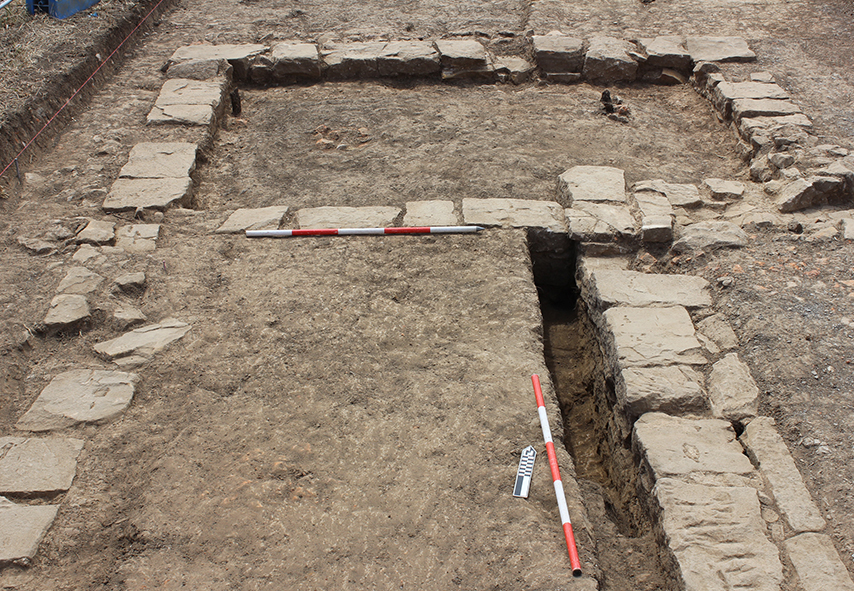
Plate 1: The northern “wing” at the front of the building. The building faced west, which is left in the photograph. View to the north, north-west.
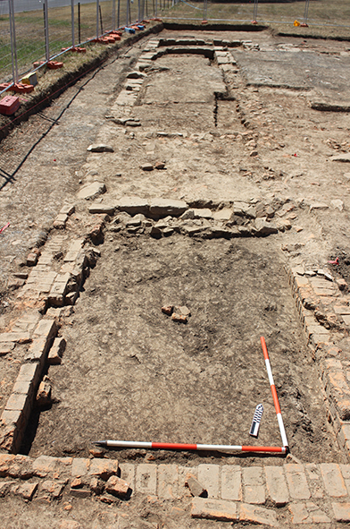
Plate 2: (above) View along the front of the building with what is probably the second-phase wing room on brick footings in the foreground. The original south wing on sandstone footings beside it that was incorporated into the verandah further along and the north wing in the background. View to the north, north-west.
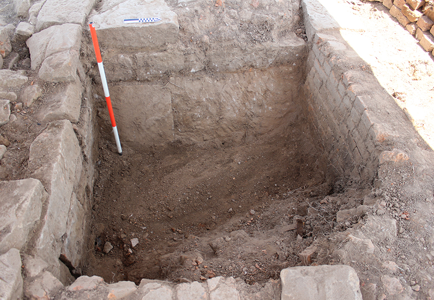
Plate 3: View into the sub-surface room that has been described as the entry into the cellar. Note the slanting sandstone blocks to the left; there is another sandstone block emerging from the deposit that was not excavated. The wall directly above them (and under the north arrow) is possibly an outside wall and is shown in context in Plate 2. View to the north-west.
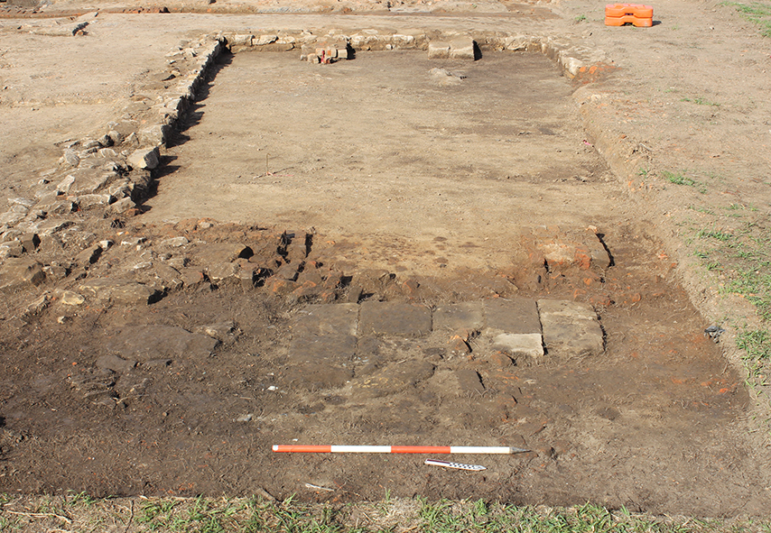
Plate 4: This feature has been identified as representing a detached kitchen supported by the fireplace base at its eastern extent (front) represented by the flagstones behind the range poles, and another fireplace base at the eastern end. Compare the structure of the footings in this building with those in the main inn building shown in the other photographs. View to the west.
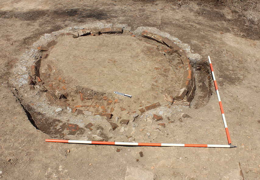
Plate 5: The cistern located at the rear of the inn building. The cistern is approximately 2.5m in diameter and is constructed of sandstock bricks with a crushed shale packing around the outside perimeter. View to the north-east.
First appeared in the ASHA Newsletter 2014, vol 44, no 2&3, pp 14-17